← Home · Laboratory

Atterberg Limits Testing for Whangarei Soils

Together, we solve the challenges of tomorrow.

LEARN MORE →

Whangarei's subtropical basalt-derived soils present a classification challenge that textbook geology rarely captures. With annual rainfall exceeding 1,300 mm in the Whangarei District, the fine fraction of local residual clays undergoes significant moisture fluctuation, shifting behavior from stiff to plastic within a narrow water-content window. The Atterberg limits test quantifies this exact transition: the liquid limit where soil flows under its own weight, the plastic limit where it crumbles, and the shrinkage limit where volume loss stops. Construction on the weathered greywacke and alluvial deposits along the Hatea River requires this index data before foundation design proceeds. The team runs NZS 4402-compliant procedures on every sample, establishing the plasticity index that governs settlement and shrink-swell potential. For deeper stratigraphy where clay layers interbed with pumiceous silts, we often pair the classification with a CPT test to correlate index properties with in-situ resistance profiles.

In Whangarei's halloysite clays, a plasticity index above 30 signals mandatory ground improvement before foundation loads are applied.

Methodology and scope

A recurring mistake on Whangarei sites is assuming all volcanic-derived soils behave like low-plasticity silts. The reality around Kamo and Tikipunga is different: halloysite-rich clays with liquid limits surging past 60% appear frequently, and they consolidate slowly under load. The Atterberg limits procedure involves progressive moisture reduction using the Casagrande cup device for liquid limit determination, followed by hand-rolling of 3 mm threads for the plastic limit. Technicians record the blow count versus water content curve on semi-log paper, extracting the 25-blow intercept per NZGS guidelines. The plasticity index — liquid limit minus plastic limit — then feeds directly into USCS classification and the Casagrande plasticity chart. For road corridor projects along State Highway 1, this index determines subgrade rating and lime-stabilization dosage before any pavement structure goes in.
Atterberg Limits Testing for Whangarei Soils
Technical reference image — Whangarei

Local geotechnical context

A multi-storey development on Maunu Road encountered grey, slick clay at 2.5 meters depth during bulk excavation. Visual inspection suggested moderately stiff material, but Atterberg limits testing returned a liquid limit of 72% and a plasticity index of 38, placing the soil squarely in the high-plasticity CH zone. The original shallow footing design assumed a drained friction angle incompatible with such ductile behavior under cyclic wetting. The project paused for two weeks while the structural engineer recalculated bearing capacity and introduced a stiffened raft foundation with edge beams. In Whangarei's alternating wet-dry climate, misclassifying a CH clay as a CL silt leads to differential heave that cracks slab-on-grade construction within the first two years. The cost of the index test is negligible compared to the liability of an uninformed foundation decision.

Need a geotechnical assessment?

Reply within 24h.

Email: [email protected]

Typical values

ParameterTypical value
Test standardNZS 4402.2.1 (Liquid Limit) & NZS 4402.2.2 (Plastic Limit)
Sample mass required200 g passing 425 µm sieve
Liquid limit deviceCasagrande cup with standardized drop height
Plastic limit criterion3 mm thread crumbling at moisture content
Plasticity index (PI) calculationLL minus PL
Typical Whangarei PI range8% to 45% depending on halloysite content
Reporting turnaround3 to 5 working days from sample receipt

Other technical services

01

Grain Size Distribution

Sieve and hydrometer analysis per NZS 4402 to determine the full particle size curve, essential for distinguishing silts from clays in Whangarei's mixed volcanic deposits.

02

Triaxial Shear Testing

Consolidated-undrained and drained triaxial tests on undisturbed samples to measure effective stress parameters, particularly for the compressible clays found beneath Kamo and Onerahi.

03

Shrink-Swell Assessment

Combined Atterberg limits and linear shrinkage testing to predict volume change potential, critical for residential slabs in Whangarei's seasonal moisture regime.

Regulatory framework

NZS 4402.2.1:1988 Methods of testing soils for civil engineering purposes – Soil classification tests – Determination of the liquid limit, NZS 4402.2.2:1988 Determination of the plastic limit, NZGS Guideline for Field and Laboratory Soil Classification (current edition)

Questions and answers

How much does Atterberg limits testing cost in Whangarei?

Standard Atterberg limits testing (liquid limit and plastic limit on one sample) ranges from NZ$90 to NZ$170 depending on sample condition and whether preparation time is required. Multi-sample projects or urgent turnaround requests fall at the upper end of this range.

What sample size do you need for the test?

We need approximately 200 grams of material passing a 425 µm sieve. The sample should be representative of the fine fraction of the soil. If you are sending a bulk bag, one kilogram of field-moist material gives us ample material for the required preparation.

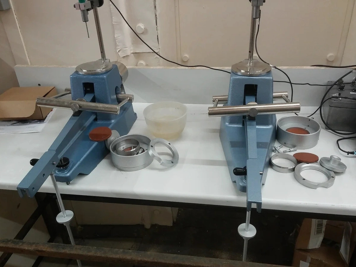
Which standard do you follow for the liquid limit?

We follow NZS 4402.2.1 using the Casagrande cup method with a standardized drop height and grooving tool. The result is reported as the moisture content corresponding to 25 blows on the semi-logarithmic flow curve, in line with NZGS classification practice.

Why do Whangarei clays have such high liquid limits?

The weathered volcanic parent material in the Whangarei area produces halloysite clay minerals with a tubular particle structure that retains significant interlayer water. This mineralogy drives liquid limits above 60% in many locations, particularly around Tikipunga and Kamo, where basalt weathering is deep and the clay fraction dominates.

Location and service area

We serve projects in Whangarei and surrounding areas.

View larger map